
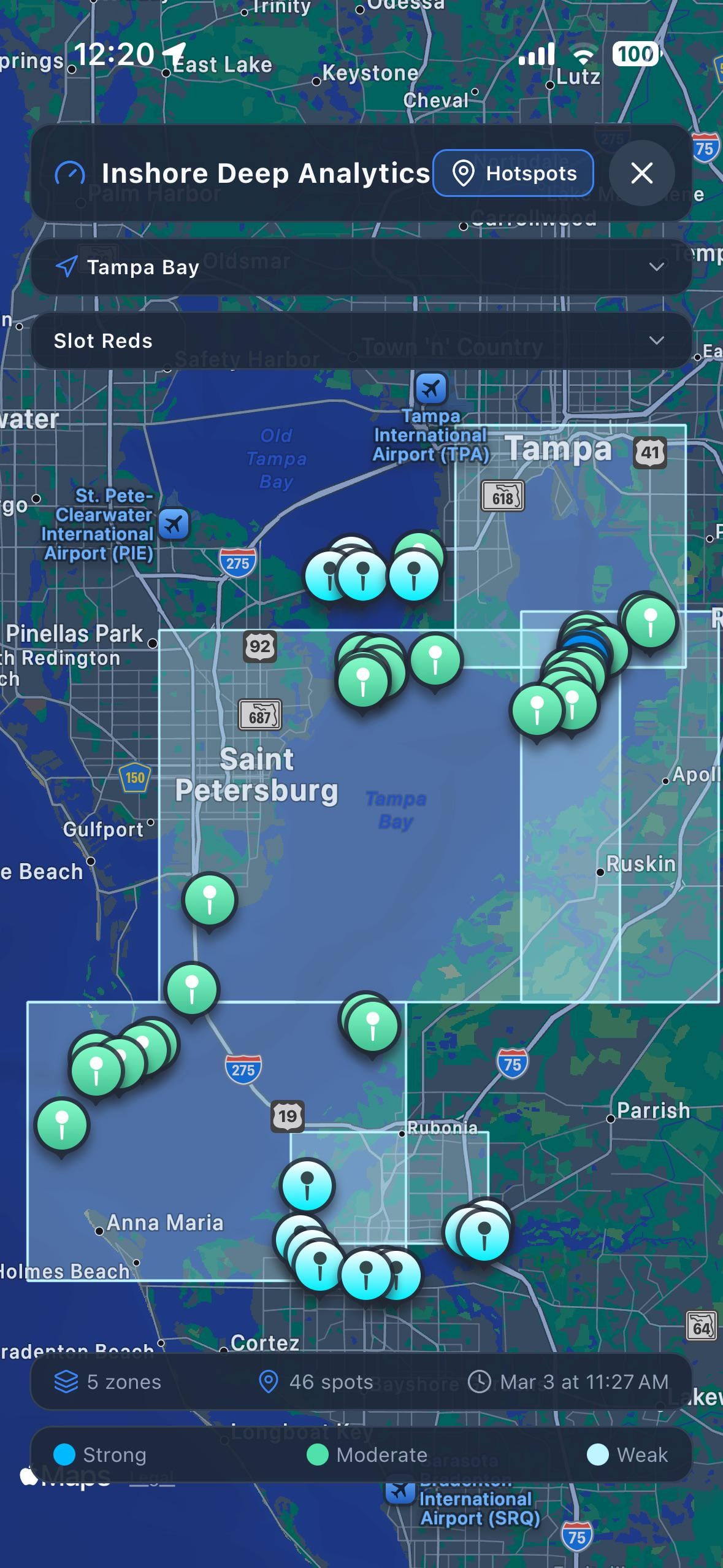
Hey everyone, a lot of you have seen me post about my offshore mode for predicting conditions and where to fish on a given day. I’ve gotten a ton of questions about whether I could build something similar for inshore, and the answer is yes and I’ve been working on it.
After a lot of research, I found that I can only reliably pull high-quality hydrodynamic data (real-time currents, water temp, salinity) from 8 specific regions where NOAA runs dedicated forecast models for those estuaries. These are the 8 I’m building out:
1.  Tampa Bay (almost live)

2.  Chesapeake Bay

3.  Delaware Bay

4.  NY/NJ Harbor

5.  Long Island Sound

6.  St. Johns River

7.  Northern Gulf (Mobile Bay, MS Sound, Pensacola, Panhandle)

8.  San Francisco Bay
I’m currently building out Tampa and will start working on the other 7 after that. Eventually I’d love to expand into more areas, but these regions are the priority right now since that’s where the high-resolution data actually exists.
Basically the idea is it scores inshore spots by species based on what the currents, tides, depth, and structure are doing at any given time so instead of just checking the tide chart, you can see where conditions are actually lining up for the fish you’re targeting.
Wanted to gauge interest:
∙ Are you fishing in one of these areas?

∙ Would you be willing to try the inshore predictions before your next trip and tell me if they match what you’re seeing on the water?

∙ Any overall feedback or thoughts on what you’d want from something like this?
Posted by Degeneratetrader9