
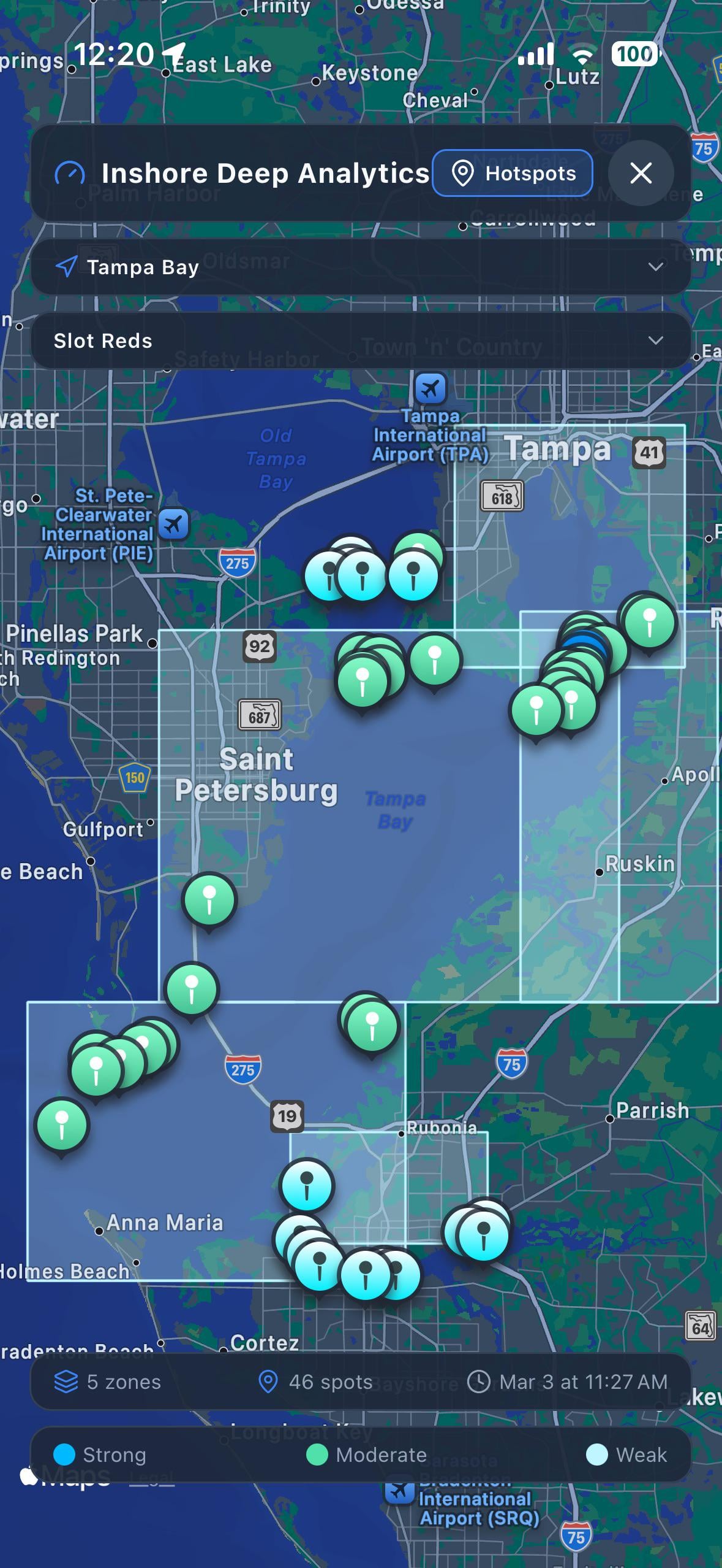
I’ve been messing around with NOAA’s hydrodynamic forecast data they run high-resolution current/temp/salinity models for specific estuaries and I’ve been trying to build inshore predictions off of it. Basically scoring spots by species based on what the currents, tides, and depth are doing at a given time.
The catch is that NOAA only runs these detailed models for a handful of places:
∙ Tampa Bay

∙ Chesapeake Bay

∙ Delaware Bay

∙ NY/NJ Harbor

∙ Long Island Sound

∙ St. Johns River

∙ Northern Gulf (Mobile Bay, MS Sound, Pensacola, Panhandle)

∙ San Francisco Bay
If you fish inshore in any of these areas, I’m curious:
∙ Do you currently use any kind of current data or just go off tide charts when you plan trips?

∙ Would real-time current-based predictions for specific species actually change how you pick spots?

∙ What would you actually want to see if something like this existed?
Posted by Degeneratetrader9