
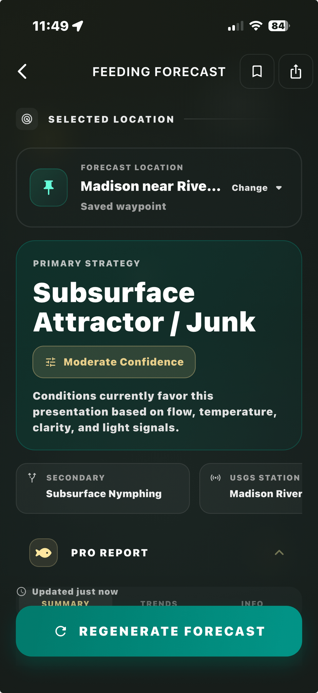
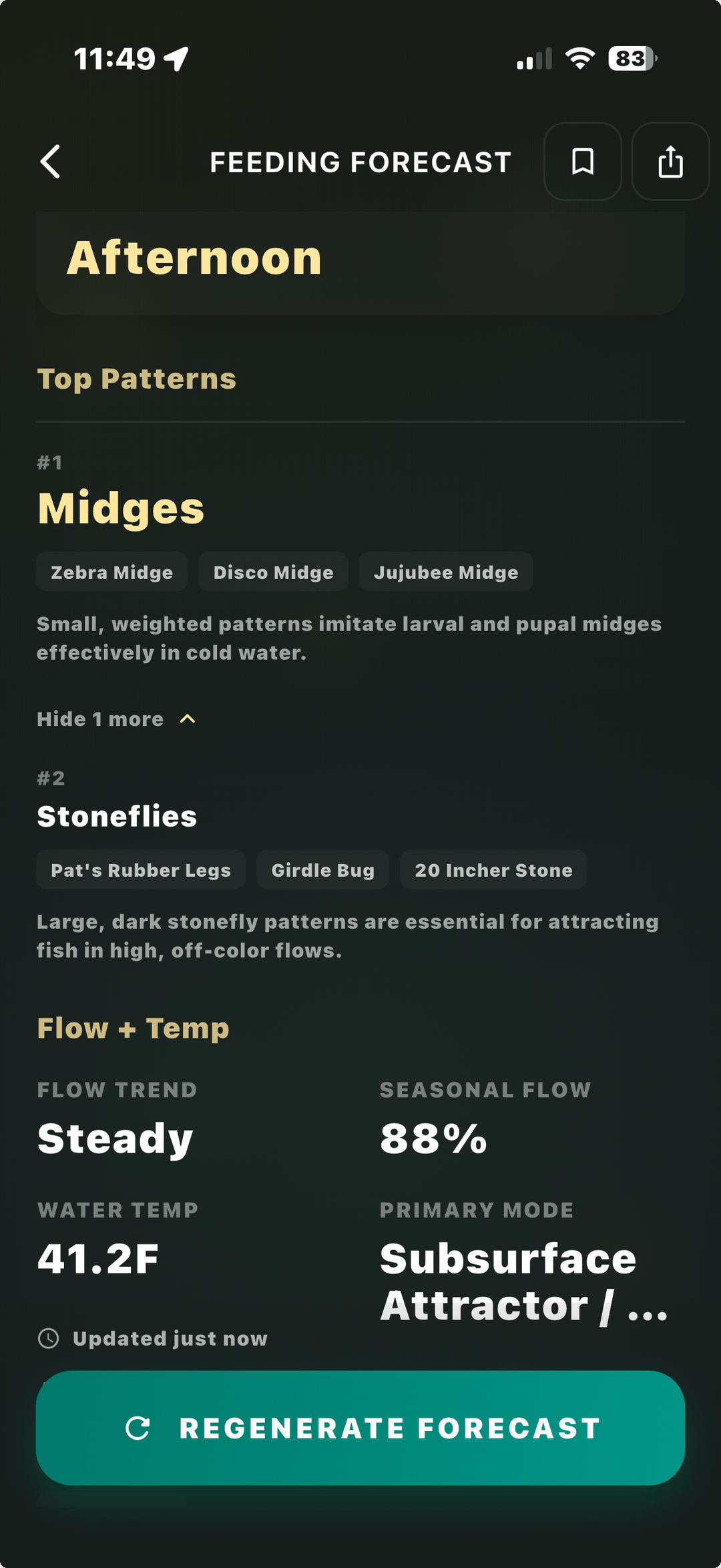
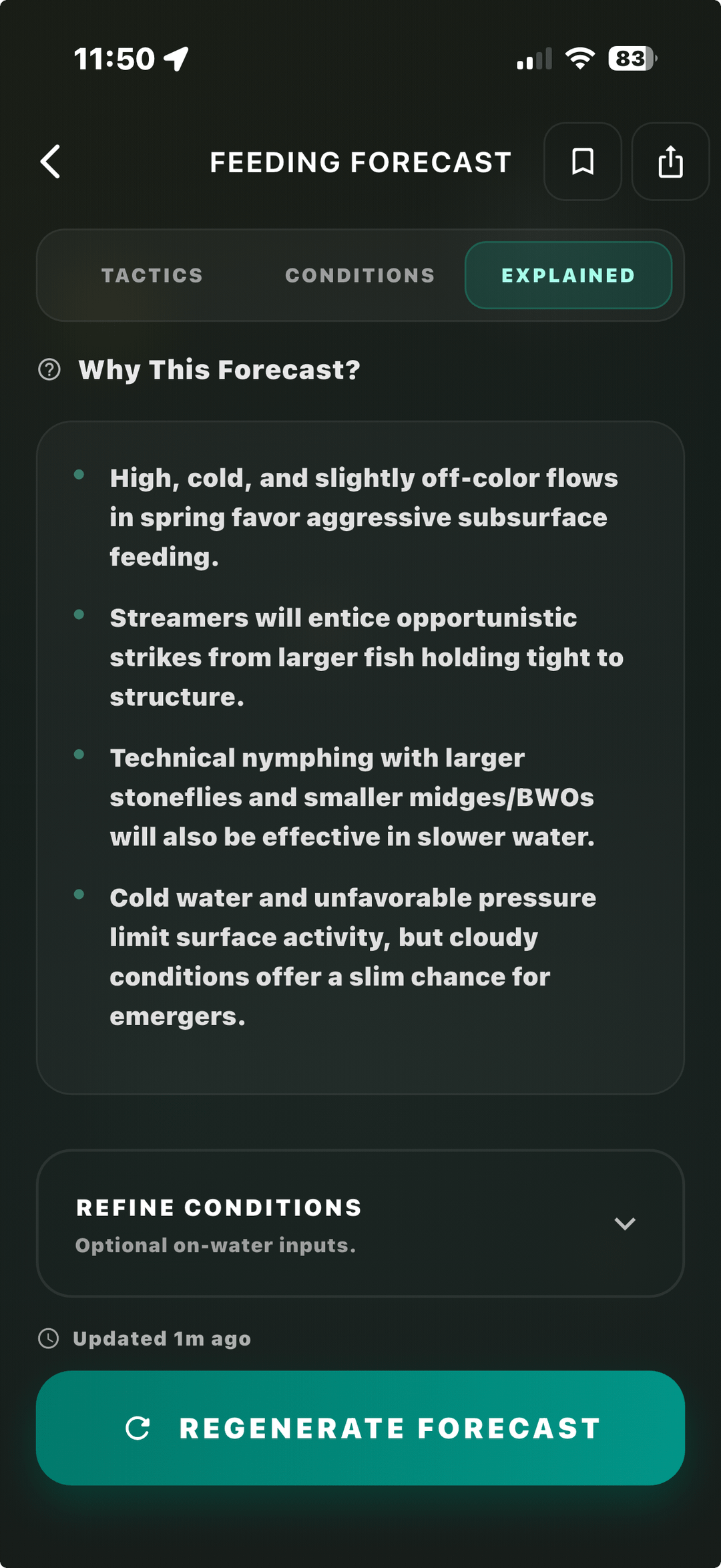
I’ve been trying to model what trout are actually feeding on using river + weather data instead of relying on reports.
Ran it for the Madison (around Ennis) images attached are what it gave:
Something about this feels slightly off to me, but I can’t tell if that’s the model or just my bias.
If you’ve been on the Madison recently — what would you expect right now?
Posted by Secure-Researcher582